
LiDAR has become one of the most fascinating tools used in investigations like Skinwalker Ranch because it can turn invisible space into a visible map. By firing laser pulses and measuring how long they take to return, LiDAR can build a detailed picture of terrain, objects, surfaces, and sometimes the airspace around a target area. But when the data appears to show an unusual shape, the first question should not be whether something extraordinary has been found. The better question is whether the shape represents a real object, a scanning artifact, or a feature created by environmental conditions. Dust, smoke, rain, reflective surfaces, uneven ground, data stitching errors, and device movement can all affect the final image. A LiDAR anomaly is not necessarily a real object; it may be a clue that needs to be checked with several different tools.
Why LiDAR Became Such a Powerful Tool on the Ranch
LiDAR fits naturally into the Skinwalker Ranch investigation because the show often focuses on places where ordinary cameras may not tell the whole story. The technology uses laser light to measure distance, sending out pulses and recording how long they take to bounce back. When those measurements are collected thousands or millions of times, they can create a point cloud, which is a three-dimensional map made from countless tiny data points. That makes LiDAR useful for scanning terrain, structures, trees, rock faces, and open areas where the team wants a more precise view. In a place like the Triangle or the Mesa, that kind of mapping can make invisible questions feel more concrete.
The reason LiDAR can feel so dramatic on screen is that it turns empty space into something people can actually see. A strange cluster of points, a missing section, a bubble-like boundary, or an unexpected curve in the data can instantly attract attention. For viewers who follow the show closely, those shapes can seem like visual evidence that something unusual is happening. But LiDAR does not take a normal photograph in the way a camera does. It builds an image from measurements, and those measurements can be affected by the environment, the equipment, and the way the data is processed.
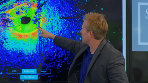
That distinction is important because LiDAR data can look convincing even when the source of the shape is not fully understood. A scan may show a strange outline, but the outline could come from a real surface, a partial reflection, moving dust, or a processing issue. If the device is moving during the scan, even slightly, the final point cloud may contain distortions that appear more meaningful than they are. If multiple passes are stitched together, small alignment errors can create unusual gaps, overlaps, or shapes. Those errors do not make LiDAR useless, but they do mean the data has to be interpreted carefully.
On Skinwalker Ranch, that careful interpretation matters even more because the show often investigates areas already surrounded by mystery. When a LiDAR scan produces a strange shape near a location like the Triangle, it is easy to connect it to larger theories. The team may wonder whether the data points to an unusual boundary, a hidden structure, or an environmental effect that has not been fully explained. Those possibilities can be interesting, but they have not been confirmed by the shape alone. The scan is a starting point, not a final verdict.
How Strange Shapes Can Appear in LiDAR Data
One of the most common reasons LiDAR can create strange-looking data is the presence of particles in the air. Dust, smoke, mist, rain, or even fine debris can reflect laser pulses before they reach the intended surface. When that happens, the scanner may record points that appear to float in space or form unusual clusters. In a desert environment, dust can be especially important because wind, vehicles, drilling, footsteps, or equipment movement can send particles into the air. A cloud of dust may not be obvious in the final scan, but it can still leave a pattern that looks mysterious.
Reflective surfaces can also complicate LiDAR readings. Metal, glass, wet rock, shiny equipment, or angled surfaces can bounce laser light in unexpected directions. Instead of returning cleanly to the sensor, the laser pulse may scatter, reflect twice, or return from a different angle than expected. That can create extra points, missing points, or shapes that appear to sit in the wrong place. If the scan is taken near vehicles, instruments, cables, or rocky surfaces with mixed textures, the data may contain reflections that need to be filtered and checked.
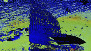
Uneven terrain is another major factor. Skinwalker Ranch includes rugged ground, rock formations, vegetation, slopes, and irregular surfaces that can produce complex returns. A flat wall or smooth surface is easier for LiDAR to interpret than broken stone, brush, dust, or a cliff face with many angles. When the laser hits jagged terrain, it may produce a layered or fragmented pattern. To someone looking at the scan, that pattern could appear like a strange shape, even if it is only the result of natural surfaces interacting with the laser.
Data stitching can make the situation even more complicated. Many LiDAR scans are built from multiple passes, different angles, or moving sensor positions. If those scans do not line up perfectly, the final model can contain false edges, duplicated shapes, or gaps that look like hidden structures. A small error in location, timing, GPS reference, or device orientation can create a visible distortion. This is especially important if the scanner is mounted on a drone, vehicle, or moving platform, because motion adds another layer of uncertainty.
Software processing also plays a role in how the final image appears. Raw LiDAR data often needs to be cleaned, filtered, aligned, and converted into a readable model. During that process, the software may remove noise, fill gaps, smooth surfaces, or classify points as ground, vegetation, or objects. Those steps can help make the data easier to understand, but they can also introduce artifacts if the settings are not appropriate for the environment. A LiDAR anomaly may be a real feature, but it may also be a sign that the scan needs to be repeated with different settings, angles, or instruments.
Why LiDAR Anomalies Still Matter Even When They Are Not Final Answers
The most useful way to understand a LiDAR anomaly is to treat it as a question rather than a discovery. If the data shows a strange shape, the next step is not to assume the shape is a hidden object. The next step is to ask whether the same shape appears when the scan is repeated from another angle, at another time, or with different equipment. If the shape disappears, it may have been caused by dust, motion, reflection, or processing. If it remains consistent, then the team has a stronger reason to study that area more closely.
That is why LiDAR remains valuable on Skinwalker Ranch even when the results are difficult to interpret. A strange shape in the data may not be proof of anything extraordinary, but it can help guide the investigation. It can show the team where to point cameras, radar, drones, GPS units, or other sensors. It can also help compare one experiment with another, especially if unusual readings seem to appear in the same location. The strength of the evidence grows when different tools point toward the same question.

For audiences interested in the mystery, this distinction makes the investigation more compelling rather than less. A clean explanation for every LiDAR artifact would remove the tension, but an unexplained shape that survives repeated testing becomes much harder to ignore. The key is not to overstate what the first scan shows. A point cloud can suggest an anomaly, but it cannot always explain what caused it. That explanation requires comparison, repetition, and careful control of ordinary factors.
This is where Skinwalker Ranch often becomes most interesting. The show is not just about one strange reading or one dramatic image. It is about whether certain locations repeatedly produce unusual results across different methods of measurement. If LiDAR shows a strange shape near an area where radar, GPS, drones, or radio signals have also raised questions, the overlap may deserve deeper review. That does not mean one theory has been confirmed, but it does make the location more important as a target for future testing.
In the end, LiDAR can absolutely create strange shapes in data for reasons that are not mysterious. Dust, smoke, rain, reflections, uneven surfaces, stitching errors, software processing, and device movement can all produce artifacts that look more dramatic than they really are. But that does not mean every strange LiDAR result should be dismissed. The real question is whether the anomaly repeats, whether it matches other data, and whether ordinary causes can be ruled out. Until that happens, LiDAR anomalies remain unresolved clues: not final answers, but important signals telling the team where to look next.
